

Hurricane Laura: Analyzing Pre-Event Residential Exposure
Currently, a total of 266,500 homes across coastal parishes in Louisiana and Texas (including Jefferson, Hardin, Orange, Calcasieu, and Cameron) are in the direct path of Hurricane Laura as it makes landfall as a Category 4 hurricane. The storm is currently predicted to pack sustained windspeeds at landfall between 125 and 140 mph and coastal areas will also be affected by a major storm surge, with some areas seeing a devastating 15-20 foot peak surge.
Another 1 million residential structures in and around the Houston metropolitan area could be impacted by hurricane-force winds, up to six inches of rainfall, as well as a 2-4 foot storm surge. Looking at the size and strength of the hurricane, we certainly hope that residents of the area are taking this event seriously, evacuate if called upon to do so by local authorities, and find a safe place to ride out the storm in the hours and days to come.
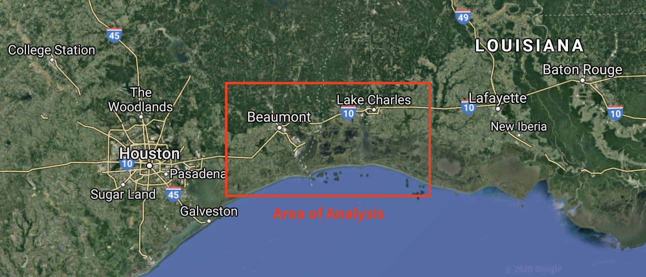
In order to analyze exposure and vulnerability within the area of projected landfall, we looked at 152,000 properties surrounding Beaumont and Lake Charles, two cities in the path of Hurricane Laura. We did this by leveraging our scalable AI infrastructure to analyze imagery captured by our partner, Nearmap.
Over 49,000 of those homes lie in Calcasieu and Cameron parishes and are in Laura’s direct path in Louisiana. These homes are forecasted to see the brunt of hurricane-force winds, centering in and around Port Charles. Another 103,000 homes within Cape’s analysis sample were across Jefferson, Hardin, and Orange counties in Texas, which could also see extremely high hurricane-force winds.
A look at the housing stock in these coastal counties allows us to better understand overall vulnerability to these hurricane-force winds at landfall. Our previous analysis of Hurricane Irma — primarily a wind event — showed a direct link between Roof Condition Rating and the likelihood and severity of loss.
Here is what homes in those areas look like, from a roof condition perspective, compared to averages in Texas and Louisiana as a whole.
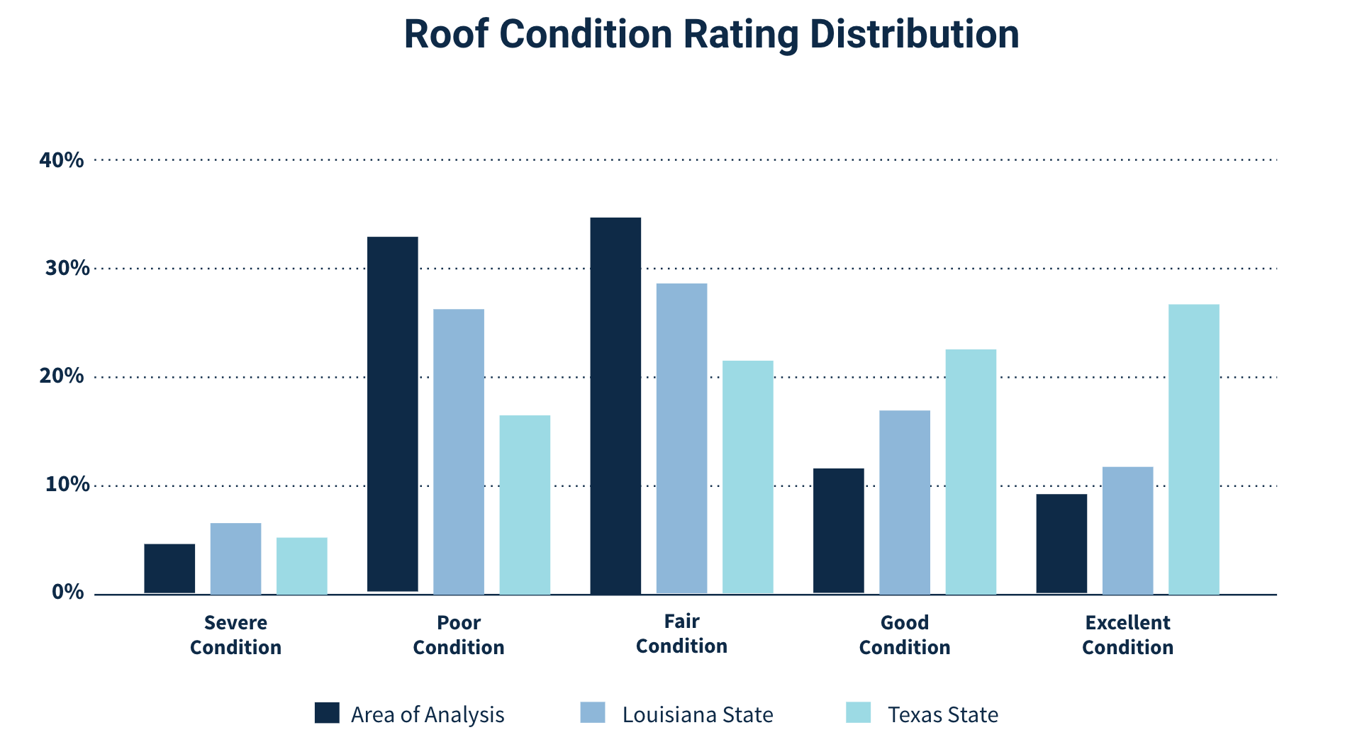
According to our analysis, 37.7% of homes in these coastal counties have poor or severe roof condition, making them especially vulnerable to strong winds. Given the prevalence of low roof condition–in addition to a storm surge that could travel well inland–it is likely Hurricane Laura will cause large scale damage to these communities. Unfortunately, these communities are even more vulnerable than other parts of Louisiana and Texas, with poor or severe roof condition 3.1% more prevalent than Louisiana as a whole, and a whopping 23.5% more prevalent than Texas as a whole.
Trees overhanging a roof are also a major source of risk in a wind event. In fact, Cape studies have shown a 90% higher loss ratio from wind-related claims, for homes with major tree coverage over the roof, compared to no tree coverage over the roof. Trees overhanging a roof dramatically increase the risk of a wind event leading to fallen limbs damaging a home.
Here’s the distribution of tree overhang across the coastal counties in Louisiana and Texas:
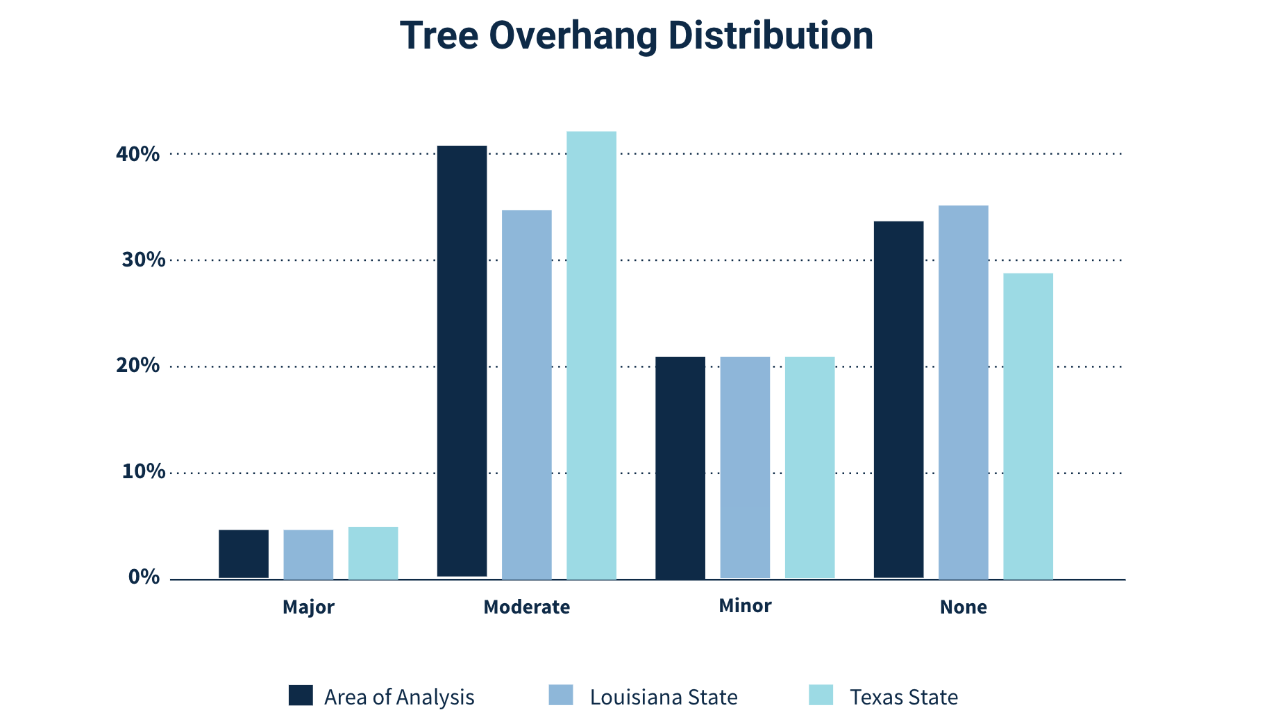
We’re seeing a good pattern here of less tree overhang in properties within the landfall path, which may help alleviate some wind-driven risk.
Lastly, roof geometry is a proven factor in mitigating damage from wind, with hip-shaped roofs being far more wind-resistant than gable shaped and flat roofs. Here is the breakdown in the coastal parishes, compared to average distribution in both Louisiana and Texas:
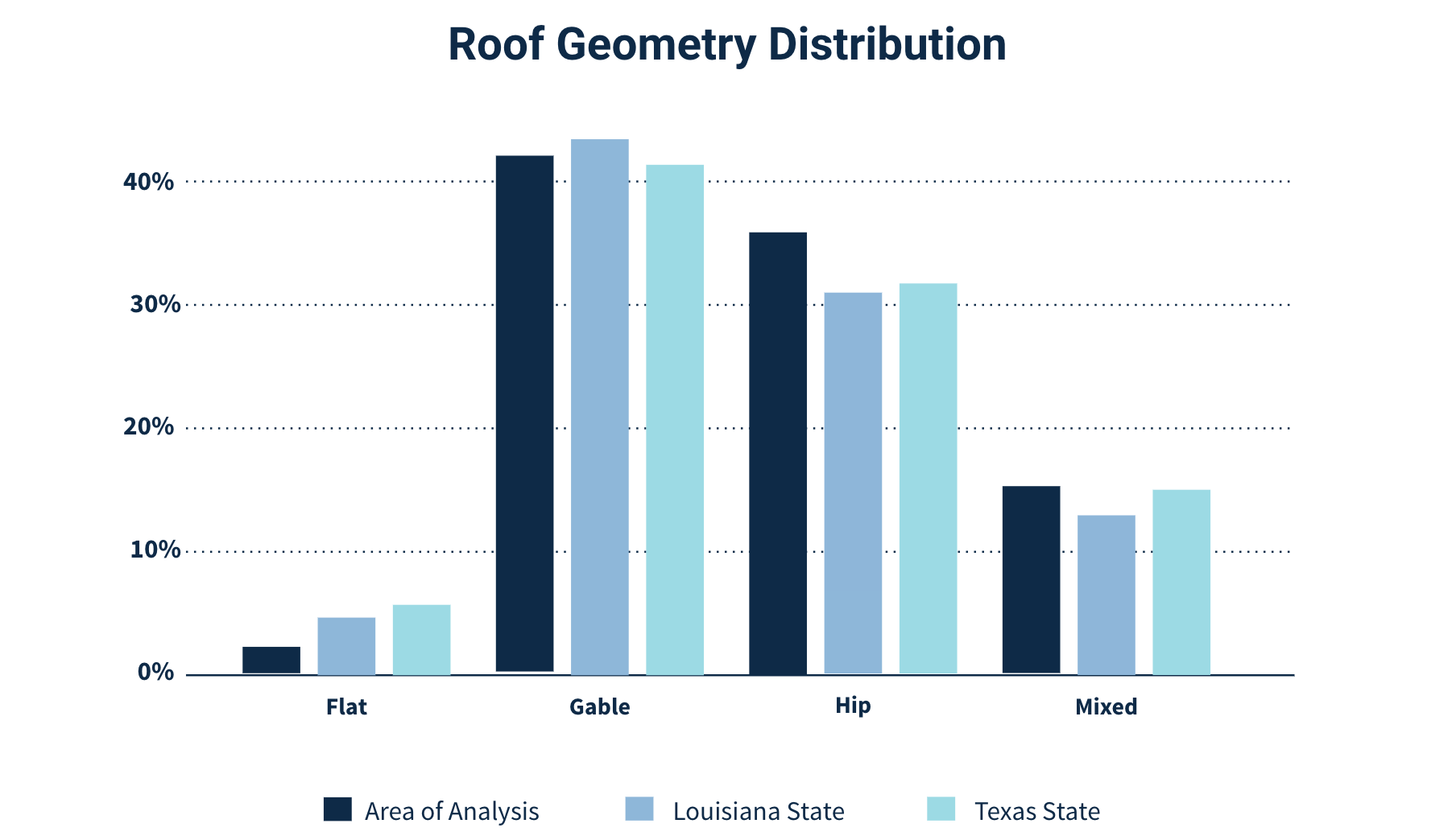
Another good indicator is the high prevalence of wind-resistant hip roofs in these areas. About 5% more homes have hip roofs compared to the average in Louisiana in Texas.
Unfortunately, overall, we are likely to see widespread damage from Hurricane Laura as it bears down on a low lying area that is vulnerable to storm surge and flooding as well as impacts from high wind speeds. As imagery providers fly these areas in the days and weeks to come, we will look to create a post-event analysis around the actual impacts.
Aggregate Statistics Created Using Data Produced from Nearmap Imagery